
Location: Itogon, Benguet
Elevation: 1,846 Meters Above Sea Level
Trail Difficulty: 3/9 (Good for beginners)
Jump-off Point: Brgy. Ampucao Barangay Hall, Itogon, Benguet
Trail Exit: Brgy. Sta. Fe, Itogon, Benguet
Features: Pine Tree Forests; Grasslands; Rolling Hills; Gungal Rock; Scenic View of the Cordillera Mountains; Hanging Bridges
Solo travel in the mountains this weekend? Soul-searching & lost in life? Problems with lovelife or family? Last-minute, random road trip? Game! Tara... Grab a backpack... Let's hike Mt. Ulap!

Mt. Ulap is the perfect weekend getaway for beginner mountain hikers coming from Metro Manila, just 45 min away from Baguio City.
Mt. Ulap, just newly opened for hikers in October 2015, is now rapidly becoming one of the hottest and most popular go-to mountains for seasoned hikers and newbie hikers this year. Celebrities like Angel Locsin, James Reid, Nadine Lustre, Daniel Matsunaga, Erich Gonzales, & the "Meant to Be" boys have recently visited Mt. Ulap, and have since posted viral photos online about their unforgettable hiking experience in Mt. Ulap.

Midnight Bus Ride to Baguio
Heavily stressed with problems in life and inspired to go soul-searching in the mountains, I decided to go on a random mountain hiking roadtrip to Mt. Ulap, in the last minute, on a free weekend. Mt. Ulap has been in my bucket list for months now. Now is the time to live the dream.
By 10:30 pm, I arrived at Victory Liner Terminal in Monumento to buy my bus ticket to Baguio. The bus left for Baguio at exactly 11 pm. The last trip from Monumento leaves at 11 pm daily, with the following trip already at 7 am the next day. However, buses leave at almost every hour of the day to Baguio, from the Cubao & Pasay terminals of Victory Liner.

Early Morning Fog in Baguio City.
The bus arrived around 4 am at Baguio City, in 5 hours' time, without traffic. Brrr... Very, very cold weather welcomed the weekend warrior to the City of Pines. I should've brought my jacket... Brrr...
Jeepney Ride from Baguio to Brgy. Ampucao
After having a heavy breakfast and buying snacks for the hike near the bus terminal, I then walked around 30 min to the jeepney terminal located in between Baguio Center Mall and Jollibee-Magsaysay Ave. (across Baguio City Public Market), at Magsaysay Ave. corner Rajah Soliman St.
I boarded the jeepney bound for "Sampucao"/"Ampucao", which costs Php 31.00. The first trip is 6:30 am daily (leaves earlier if the jeepney gets full before 6:30 am...). The "Philex-bound" jeepneys also pass by Brgy. Ampucao, but costs Php50+ for the trip.
At 7:20 am, the jeepney finally arrived at the registration site: Brgy. Ampucao Barangay Hall, right beside Ampucao Elementary School.
Registration @ Brgy. Ampucao Barangay Hall
After paying the registration & guide fees, I then met my guide for the day, then off I go to start my hiking adventure in Mt. Ulap!

Starting Point: The Map of the Mt. Ulap Hiking Trail
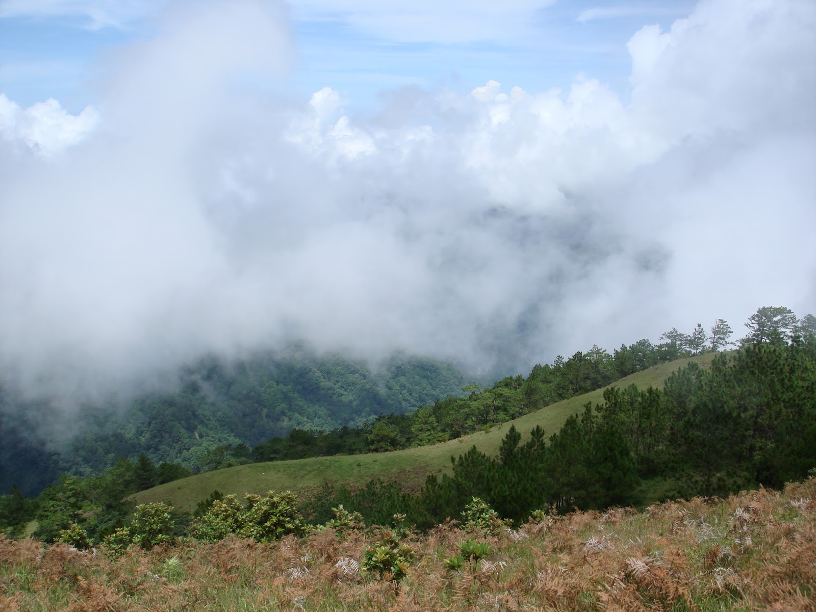
The first part of the hike was a series of intense, steep assaults up the mountain. Along the way, I was rewarded with great, scenic views of the famous pine tree forests in Benguet and the tall, mighty Cordillera mountains standing in the distance.
Hiking through the pine tree forests along the trail will take you to a whole new, different world, like going through the woods in Hollywood films like "Twilight", "Into the Woods", or "The Hunger Games". Perfect for soul-searching. Hiking through the woods helped me renew my fighting spirit for life and develop a much bigger love for the great outdoors.

Pine Tree Forest Along the Trail.

Welcome to the Woods.

Spectacular View of the Mighty Mountains in the Distance.

Soul-Searching in the Mountains

The Grand View of the Cordillera Mountains Along the Trail
Peak #1: Ambanaw Paway
After 1 hr 10 minutes of hiking in steep assaults up the mountain, my guide & I finally arrived at the first peak. At 1,788 Meters Above Sea Level, Ambanaw Paway is the first of three peaks in the hike.
Ambanaw Paway (which means "wide area") refers to the endless grasslands found in this area during the hike.

The 1st Peak: Ambanaw Paway.

The Camp Site at Peak #1: Ambanaw Paway.
Near the first peak, there are also several strange rock formations along the way, which can serve as perfect stops for picture-taking and rest stops to catch one's breath during the climb. You will get to encounter several cows grazing in the grasslands on the way to the 2nd peak, as well.

Strange Rock Formations Along the Trail

More Rock Formations Along the Trail

Cow Grazing in the Grasslands

My Guide & A Dog that Joined Our Group near the 1st Peak.

The Cute Doggy That Joined Our Group While Climbing to the Summit.
The trail going to the 2nd peak mostly passes through flat, hilly grasslands, exposing hikers to the scorching heat of the sun. However, the views of cows grazing in the grasslands, the lush greenery, and the view of the great mountains in the distance will definitely make the walk very enjoyable and very breathtaking. After 1 hr 5 min of hiking, we finally arrived at the 2nd Peak.
The highlight and most famous landmark in Mt. Ulap is Gungal Rock. At 1,814 Meters Above Sea Level, Gungal is the second of three peaks in the trail.

Peak #2: Gungal
However, hikers must exercise caution in posing for photos at the Gungal Rock, because getting to the rock is very dangerous, with the rock tilted at a dangerous, uneven, sliding angle. One wrong step will lead you slipping down the tilted rock straight into the cliffs below with nothing to stop your fall. Don't worry, guys, my guide told me that no one has died yet so far while taking photos on Gungal Rock.

Gungal Rock: The Weekend Warrior v.s. The Sea of Clouds

Heaven & Earth

Cool Rock Boulder near Gungal Rock

The Final Approach to the Summit
From Gungal Rock, I finally arrived at the summit of Mt. Ulap within 45 minutes.
Peak #3: Mt. Ulap
The view was breathtaking at the summit of Mt. Ulap (Peak #3). I was on top of the world, at 1,846 Meters Above Sea Level, above the sea of clouds Mt. Ulap is very famous for.
My guide and I then had our lunch at the summit, while enjoying the spectacular view of the tall, mighty mountains which are now below us and the famous sea of clouds at the summit.

Peak #3: The Summit of Mt. Ulap
Picture-Perfect View at the Summit of Mt. Ulap

The Weekend Warrior at the Summit of Mt. Ulap

Strange Mushrooms Found at the Summit of Mt. Ulap
The Descent
Going down the mountain was just easy, taking only 1 hr 15 min to reach the end of the trail. The views along the way were nevertheless very breathtaking and picture-perfect, with rolling hills, lush grasslands, pine tree forests, wild rivers, and hanging bridges.
There are several burial caves, with ancient coffins and mummies buried inside, that can be found along the way during the descent down Mt. Ulap. Unfortunately, the burial caves are now closed for public viewing, with the trail now redesigned to traverse a different route away from the burial caves. Nevertheless, the hike is still very breathtaking with some of the best views of nature I've ever seen.

Start of Descent from the Summit

Wooden Staircase Going Down the Mountain

Endless Views of Rolling Hills

More Rolling Hills Along the Trail

Entering a Pine Forest in the Descent

This Cute Little Cat Joined Our Group in the Descent...

The Cute Little Cat That Joined Our Descent Down Mt. Ulap

Benguet Coffee Beans Growing on Trees Along the Trail
The climb down the mountain was fun and way easier than the ascent. However, extra care must be given during the descent because the rocky, muddy trail can get quite slippery during rainy days. Fortunately, the trail was dry during my hike after days with no rain.
The End of the Trail
Hanging bridges and river crossings will eventually mark the end of the trail, at Brgy. Sta. Fe.

The Hanging Bridge near the Trail Exit

The Trail Exit @ Brgy. Sta. Fe
The Long Ride Back to Metro Manila
After washing up and resting at the Sta. Fe Trail Exit, my guide and I then hitchhiked in the van of a kind, local family back to the Barangay Hall in Brgy. Ampucao. Jeepneys rarely pass by the Sta. Fe Trail Exit, so we had to hitchhike our way back to Brgy. Ampucao with some kind locals. Then, I rode a jeepney from the Ampucao Barangay Hall to the Victory Liner Terminal in Baguio City. The bus left at 3 pm from Baguio City, and arrived back in Metro Manila by 9:40 pm.
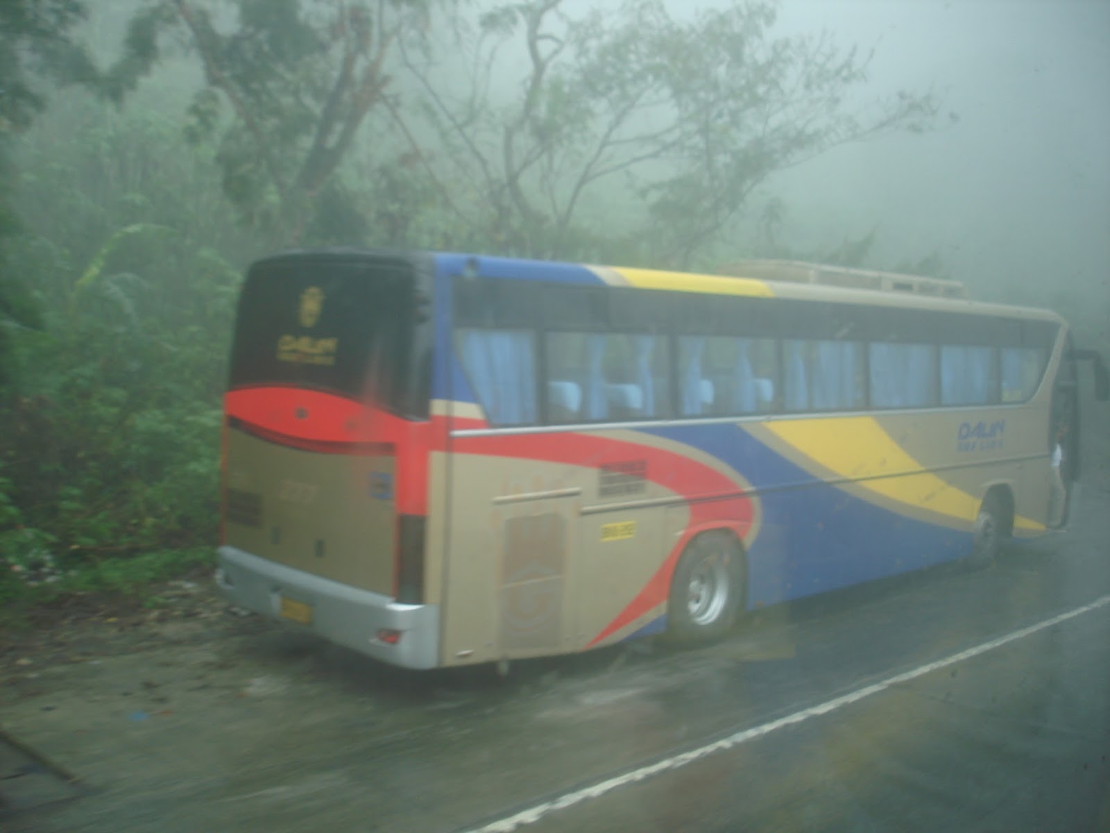
Fog on Kennon Road, Baguio City

Fog Cover along Kennon Road
HOW TO GET TO MT. ULAP:
[By Commute]
- BUS [Metro Manila to Baguio]: Take the Victory Liner bus to Baguio City from Monumento, Cubao, or Pasay. P450.00. (Note: Buses from Cubao/ Pasay leave every hour of the day. Last trip from Monumento is 11 pm. First trip from Monumento is 7 am.)
- JEEPNEY [Baguio to Brgy. Ampucao (registration site)]: Go to to the jeepney terminal between Baguio Center Mall and Jollibee-Magsaysay St. (across Baguio City Public Market) at Magsaysay St. cor. Rajah Soliman St. Take the jeepney with the signboard "Sampucao" or "Ampucao". First trip for the day: 6:30 am. (Leaves exactly 6:30 am even if not full; will leave earlier if jeep gets full...) Tell the driver you will go down at Brgy. Ampucao Barangay Hall/ Ampucao Elementary School (the registration site/ jump-off point). P 31.00 (21 km).
[Private]
- Drive to Baguio City from Metro Manila via NLEX-TPLEX-McArthur Highway.
- Turn right to Kennon Road, and drive up to Baguio City.
- From Baguio City, drive towards Loakan Road, then drive towards Itogon/ Philex, and make a left turn towards Ampucao Elementary School/ Brgy. Ampucao Barangay Hall.
BUDGET:
- Bus Ride [Monumento to Baguio]: P450.00
- Jeepney Ride [Baguio to Brgy. Ampucao]: P31.00
- Registration Fee: P100.00
- Guide Fee (Group of 7): P600.00
- Souvenir (Mt. Ulap Bagtag): P35.00
- Meal Budget (Heavy Breakfast/ Lunch/ Snacks): P150.00
- Jeepney Ride [Brgy. Ampucao to Victory Liner Terminal-Baguio]: P30.00
- Bus Ride [Baguio to Monumento]: P450.00
----------------------------------------------------------------------------------------------
TOTAL EXPENSES: P 1,846.00 (Solo Hike)
(Will be way cheaper with more people in the group, P600 guide fee to be shared by group members)
MT. ULAP DAYHIKE ITINERARY:
10:30 pm: Buy bus ticket at Victory Liner Terminal - Monumento.
11:00 pm: Bus Ride: Monumento to Baguio (via Victory Liner) [5 hrs]
(Last trip for the day from Monumento at 11 pm, next trip at 7 am)
(Victory Liner buses from Cubao/ Pasay leave every hour of the day. Check their website for trip schedule.)
4:00 am: Arrival @ Baguio City. Heavy Breakfast. Go to jeepney terminal along Baguio Center Mall.
6:30 am: Jeepney Ride: Baguio to Brgy. Ampucao Barangay Hall/ Ampucao Elementary School (Registration Site) [50 min]
(First jeepney trip: 6:30 am; will leave earlier if gets full...)
7:20 am: Arrival @ Brgy. Ampucao Barangay Hall (Registration Site). Register. Pay Registration & Guide Fees.
7:45 am: Start Hike.
8:55 am: Peak #1: Ambunao Paway
10:00 am: Peak #2: Gungal Rock.
10:45 am: Peak #3: Mt. Ulap; Lunch at the Summit. Enjoy the View.
11:35 am: Start Descent.
12:50 pm: End of Hike. (Sta. Fe Trail Exit). Wash Up. Buy Snacks & Souvenirs. Rest.
1:20 pm: Hitchhike back to Brgy. Ampucao Barangay Hall.
1:45 pm: Jeepney Ride: Brgy. Ampucao Barangay Hall to Victory Liner Terminal, Baguio City. [40 min]
2:25 pm: Arrival @ Victory Liner Terminal - Baguio. Buy bus ticket. Snacks. Souvenir-shopping at the terminal for pasalubong.
3:00 pm: Bus Ride: Baguio to Monumento [6 hr 40 min w/ traffic]
9:40 pm: Arrival @ Victory Liner Terminal - Monumento. End of Roadtrip.
MT. ULAP CONTACT DETAILS:
Brgy. Ampucao Tourism: 0946-115-9154 (for reservations)
Mt. Ulap Facebook Page: https://www.facebook.com/mtUlap/ (for reservations)
My Hiking Guide: Ms. Agustina "Tina" Lagani: 0910-342-4194
Note: Reservation is required in advance, esp. during the peak season (cold season/ summer months):
[1] via reservation link on Facebook page, or [2] text/call Brgy. Ampucao Tourism (I just texted...)
UPDATED FEES: (as of September 2017)
Registration Fee : Php 100.00/ person (Required)
Guide Fee (Required): Dayhike - Php 600.00/ group of 7 persons
: Overnight Camping - Php 1,000.00/ group
Campsite Fee : Php 800.00 (Overnight Camping for group of 10 persons and below)
Porter Fee (Optional): Dayhike - Php 500.00 (Optional)
: Overnight Camping - Php 800.00 (Optional)


